![[C]Worthy](http://images.squarespace-cdn.com/content/v1/66b3f00a872f892fc1c3299b/02f683d5-3e94-4cc3-90e5-cc909ba570a6/01-CWorthy-Wordmark-Red-RGB.png?format=1500w)
How to Use the OAE & DOR Efficiency Maps
Knowing where and when ocean-based carbon dioxide removal (CDR) deployments could be most effective is challenging. Ideally, ocean alkalinity enhancement (OAE) or direct ocean removal (DOR, sometimes also referred to as direct ocean capture) interventions are placed in ocean regions where environmental conditions will maximize carbon uptake. Efficiency can vary based on ocean currents, wind speeds, and seasonal changes in surface water chemistry. That’s exactly what the Efficiency Maps are designed to illuminate.
The OAE Efficiency Map and DOR Efficiency Map are online, interactive tools created in collaboration by [C]Worthy and CarbonPlan to provide insight into patterns controlling CDR efficiency and guide more effective deployments. In addition to these tools, [C]Worthy has released the underlying research-grade data as entries in the Ocean CDR Atlas.
In this 11-minute conversation and demo, [C]Worthy co-founder and CEO Dr. Matthew Long and Sr. Technical Project Manager Joe Gaines provide:
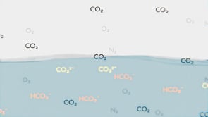
A quick but thorough overview of what OAE and DOR are, why they matter, and how they can be modeled
The motivation for creating these tools and an understanding of the problems they are trying to solve
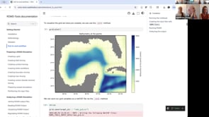
A walkthrough of each interactive tool, how to use them, and how you can try them for yourself
But this is not the end of the story—at [C]Worthy we plan to release updated and higher fidelity datasets, improving the quality and scientific integrity of the Ocean CDR Atlas. Stay tuned.
Explore the tools: https://carbonplan.org/research/mcdr-tools